 |
 |
Scientific Biography of
Dr. M. Jamil Andalibi
Researcher,
Professor of Applied Geology at
Research Institute of Earth Sciences,
Founder and Former Director of
Geological Survey of Iran - Shiraz Center.

M. Jamil (M. J.) Andalibi, born in 1951 of a well-known family of music, science, art and mysticism, is the fisher professor of Quaternary geology, the professor of applied geology at Research Institute of Earth Sciences and the founder and former director of Geological Survey of Shiraz Center (Fars province of Iran).
Andalibi is best known for his works on Quaternary systems and applied sciences such as urban geology and engineering geology, and has long standing interest in active tectonics, contemporaneous movements and seismic microzoning. He made his name in applied geology and Quaternary systems using earthquake source seismology, seismites and seismic precursors to examine how the Alpine-Himalayan orogenic belt, specifically Iranian portions (Alborz, Zagros and central Iran) are deformed. He is also the faculty member of GSI Research Institute and part-time professor in University of Isfahan, Azad University of Tehran and other graduate schools.
Andalibi was born in Sanandaj (Kurdistan province of Iran) and graduated from the University of Tehran with a bachelor of general geology in 1980. He received his Ph.D. in 1989 for dissertation entitled "Quaternary phenomena in Qazvin depression (west of Tehran)" including the study of tectono-sedimentology, tectono-environment and neo and contemporaneous movements (seismites) of Qazvin foreland.
As previously mentioned, simultaneous with his researches and teaching, Andalibi founded and established the Geological Survey of Shiraz Center (Fars province of Iran).
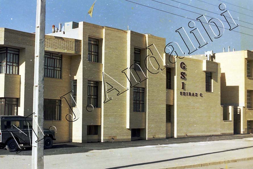
Central Building of Geological Survey of Iran, Shiraz Center (Founded on 19th April 1993)
He was the general director of the center for 13 years during which he carried out many large, fundamental and basic projects. Some of his major activities during this period include:
1. Preparation of 13 sheet geological map of 1:100,000 scale.
2. Scientific supervision of 46 sheet geological map of 1:100,000 and 1:50,000 scale.
3. Preparation of the first Quaternary lithostratigraphic and the first microzoning maps in Iran (for Shiraz area and eastern parts of Caspian basin).
4. Researcher and executive of practical studies in major seismotectonic and engineering geology projects.
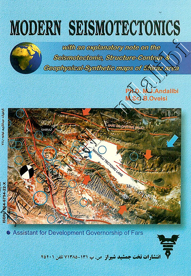
5. Authorship of the 315-page book of “Modern Seismotectonics” on the basis of field observations (M. Jamil Andalibi, Behnam Oveisi). The book has been used as a methodology for engineering geology and urban geology studies, and is taught in multiple engineering geology graduate-level programs of different universities such as faculty of engineering of University of Shiraz, etc.
6. Preparation of the first seismic microzoning map for the city of Shiraz (the first step in urban planning) along with seismotectonic, structure-contour and synthetic-geophysical maps of Shiraz area (M. Jamil Andalibi, Behnam Oveisi).
7. Authoring 196 mostly-practical national papers and reports containing new and valuable discoveries achieved from field observations.
8. Delivering 141 scientific speeches at congresses and symposia inside and outside the country.
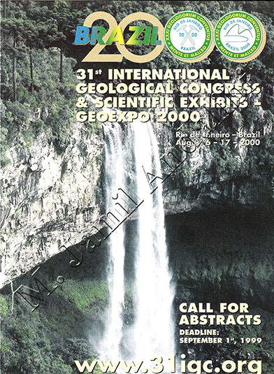
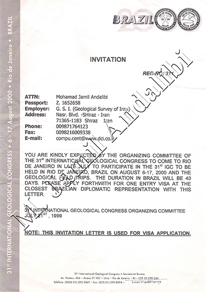
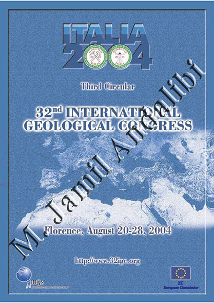
9. Presenting notable scientific papers and speeches (achieved from research discoveries), at international congresses held in Canada (1987), Washington D.C. (1989), China (1991 and 1996), Japan (1992), Brazil (2000), Italy (2004), Australia (2012), Turkey (2013) and many other countries.

10. Executive for determining seismic-safe places for reconstruction of earthquake-hit areas in city of Qaen (Khorasan province of Iran), Fars province, Bushehr province, Qazvin province, Zanjan province, etc.
11. Executive for determining new safe locations for 212 cities and villages of Fars province damaged in earthquakes or floods.
12. Professional peer-reviewing of many large projects including Mirza-ye Shirazi dam, Tangab dam of Firozabad, Takhte Sang dam of Jahrom.
13. Professional peer-reviewing of the retrofitting plan of water pipeline through Shiraz
14. Professional peer-reviewing of the retrofitting project of Shiraz petrochemical company
15. Professional peer-reviewing of the construction project of multiple cement plants, etc.
16. Project executive of multiple engineering geology studies of different important residential and non-residential sites in Fars province and other parts of the country.
17. Determination of landfill location for hazardous waste of Shiraz petrochemical company.
18. Presenting a macro plan for mining explorations of the country (at the direct request of Industries and Mines minister).
19. Direct executive of engineering geology studies of Bidzard (Nargesi) dam in Kazerun area.
20. Advisor and supervisor of 12 student theses and dissertations of graduate degree programs in Isfahan University, Azad University of Tehran North Branch and Archaeological Research Institute of Iran.
21. Membership in global committees of disaster reduction, Quaternary, earthquake, flood, environment and loess deposits.
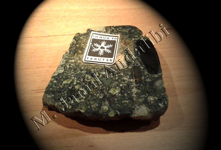
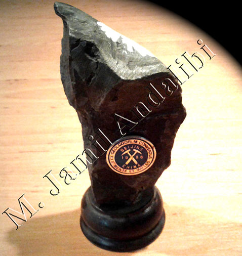
22. Aside from seismic and geodynamic based field operations in almost all portions of Iran, other notable field researches include two-month-long field studies in Siberia, the Arctic and the shield areas in 1990, long-time field studies in the Tibetan Plateau of China (1991) and studies of Quaternary volcanic areas of Japan (1992).
- And many others.
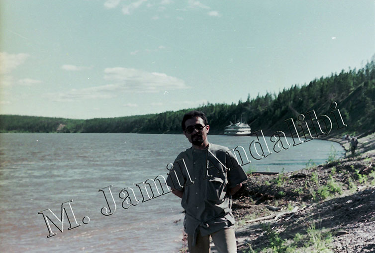
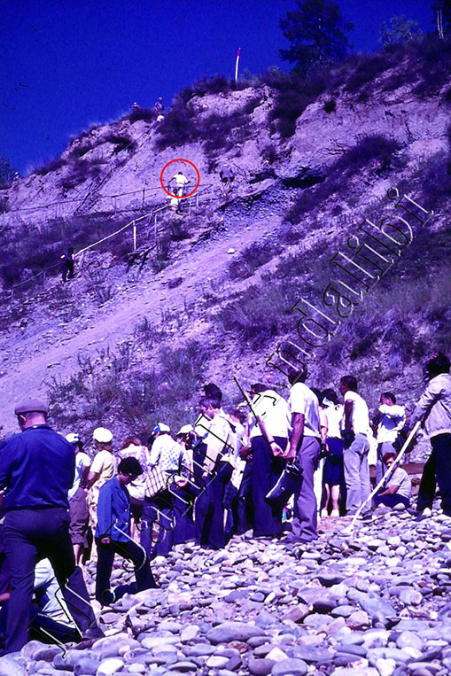
Dr. M. Jamil Andalibi, Siberia, 1990
(Stop 6: Inspection and Study of Kangalass Cape Kame Terraces, the Left Bank of Lena River)
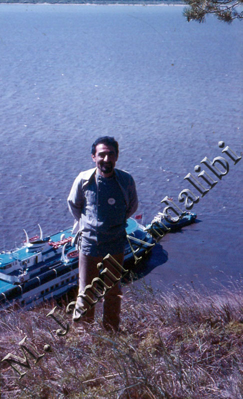
Dr. M. Jamil Andalibi, Siberia, 1990
(Stop 4: Inspection and Study of the Section of Tanda Outcrop (Magnetic-Stratigraphy), The Left Bank of Aldan River)
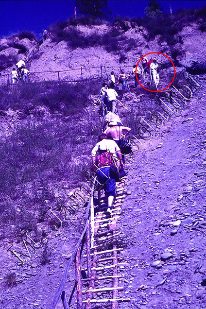
Dr. M. Jamil Andalibi in the Field Observation Group, Siberia, 1990
(Stop 3: Inspection and Study of Mammoth Hill, The Left Bank of Aldan River, 325km up the River Mouth)
He is also the author of numerous books, papers and popularizing works. His book, “Modern Seismotectonics”, being an achievement of the Modern Seismotectonics project, consists of 315 pages along with explanatory notes on 3 maps of seismotectonics, synthetic-geophysics and structure-contours of Shiraz area. The book also includes explanations about the methodology of preparing seismic microzoning map of Shiraz plain.
Back Cover of Modern Seismotectonics Book
(The Picture Illustrating Satellite Imagery of Southeast of Shiraz, Sarvestan Area, 8-12.5km Displacement from East)
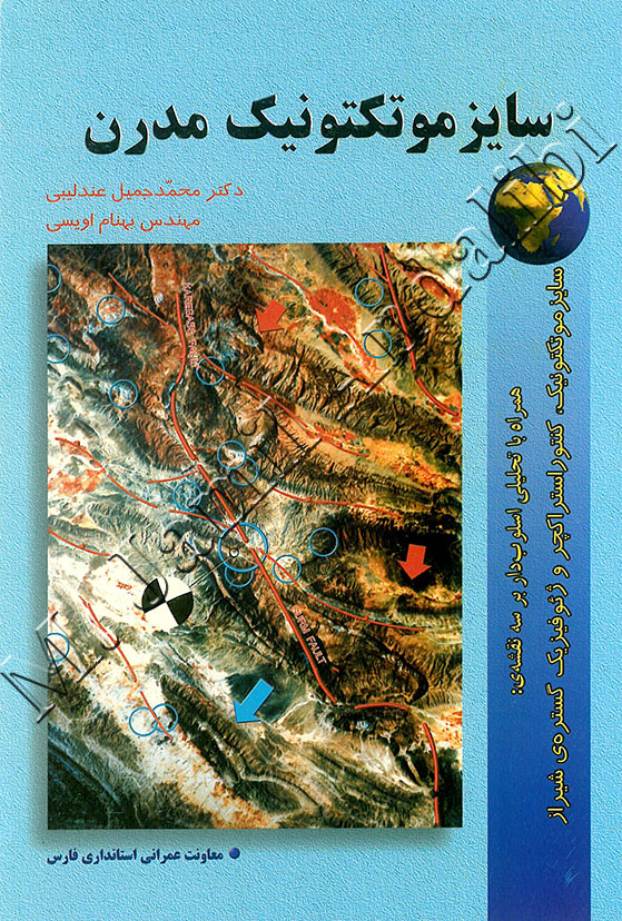
Front Cover of the Modern Seismotectonics Book
(The Picture Illustrating Satellite Imagery of Southwest of Shiraz,
Gurm Fault, A Rare Rupture with 5.2km Horizontal Surficial Displacement)
Modern Seismotectonics book is also about analyzing the major natural catastrophic events and identifying earthquake precursors in order to find and ensure seismic-safe places for reconstruction of cities and villages and urban development. The book which was published in Iran in 1999, contains many important results and discoveries and is intended for a wide range of readership in M.S. and Ph.D. levels.
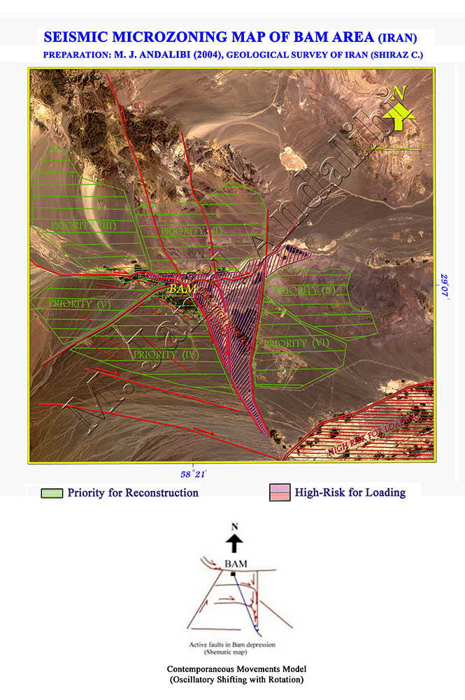
In addition to seismology, his current researches take advantage of remote sensing systems such as Radar, Landsat, GPS measurements, satellite gravimetry and aeromagnetic surveys. “Systematic Analysis of Bam Earthquake” is considered as one of his major researches in which these technologies have been used. The case study is available at:
Systematic Analysis of Bam Earthquake on Dec. 26th 2003
On top of everything else, academician M. Jamil Andalibi is a scientist of world renown and the author of numerous outstanding ideas and discoveries. For instance:
1. Introduction of earthquake precursors and seismites (as a part of Geological Survey of Iran macro plan).
2. Determination of structure orientation in order to increase resistance against earthquakes.
3. Introduction of human-induced earthquake characteristics.
4. Proving the existence of two major compressive components in Iran plate (the first one being from northeast and east, and the second one being from northwest) by means of 57 definitive reasons (disproving the old hypotheses).
5. Introduction of two new zones of Sabz Pushan and Bamou in simply-folded Zagros belt.
6. Physico-genetic classification of faults (causative and affected faults).
7. Introduction of a new method for groundwater exploration in deserts involving Quaternary and geoelectric data integration (Abadeh area, north of Shiraz).
8. Determination of earthquake hypocenter depth using aero-magnetic data.
9. Preparation of the first Quaternary-lithostratigraphy map in Iran.
10. Introduction of a new formation and tectonic phase in Caspian basin of Iran (Golijeh formation in upper-Quaternary):
https://books.google.com/books?id=rTvwAAAAMAAJ&focus=searchwithinvolume&q=andalibi
11. Declaration and classification of source and properties of Caspian basin loesses and introducing them as a recorder for past earthquakes and climatic changes (paleoseismogram).
12. Introduction of glacial-eolian loess deposits as the best raw material for ceramic and brick industry.
13. Quaternary Sediments in Western Part of Caspian Sea in Iran (INQUA, Canada, 1987).
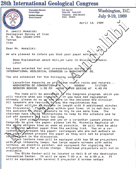
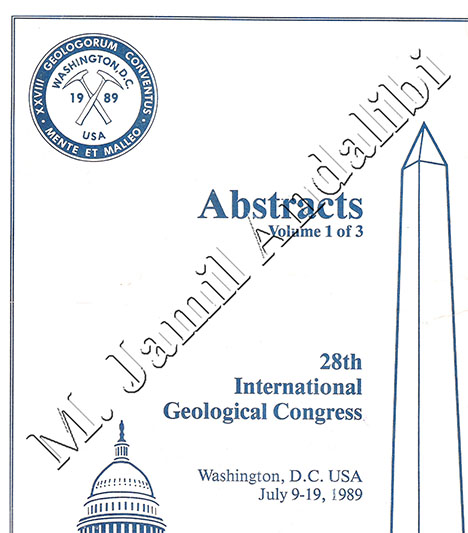
14. Some Explanation about Golijeh Paleo-Lake, a Glacial Tectonic Lake (28th International Geological Congress, Washington D.C., U.S.A., 1989):
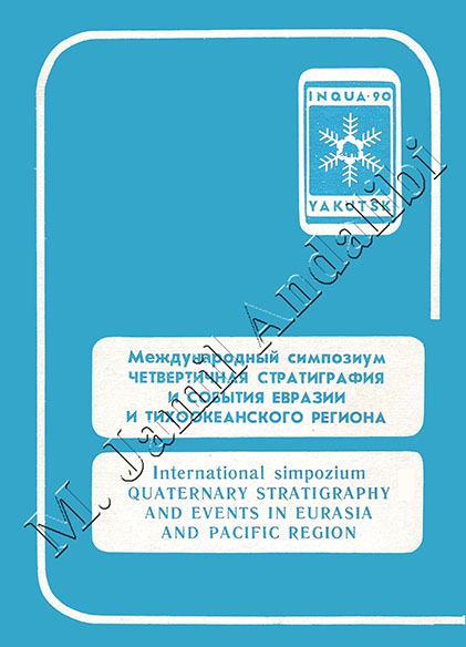
15. Recent Changes in Caspian Sea Level (3rd International Quaternary Stratigraphy and Events in Eurasia and Pacific Region, USSR Academy of Sciences (Siberia), July 1990).
16. Neotectonics and Climatic Change from Last Glaciation (China Academy of Sciences, China, October 1990).
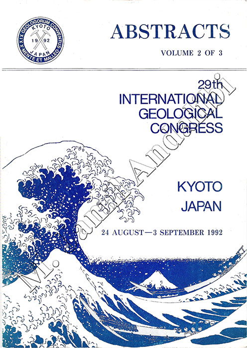
17. Characteristics, Source and Classification of Loesses of Caspian Basin in IRAN (29th International Geological Congress, Kyoto, Japan, 1992).
18. The New Estimates of Neo and Seismo Tectonics in Zagros Belt (30th International Geological Congress, Beijing, China, 1996):
https://books.google.com/books?id=CdFNAQAAIAAJ&focus=searchwithinvolume&q=andalibi
19. The New Method for Increasing Constructions Stability against Earthquake Waves (30th International Geological Congress, Beijing, China, 1996):
https://books.google.com/books?id=CdFNAQAAIAAJ&focus=searchwithinvolume&q=andalibi
20. New Tectonic Units in Shiraz Area (Sabz Pushan and Bamou) (31st International Geological Congress, Brazil, 2000).
21. Characteristics of Induced Earthquakes (32nd International Geological Congress, Italy, 2004).
22. Systematic Analysis of Bam Earthquake (26/12/2003) (Asian Disaster Reduction Center, http://www.adrc.asia, Japan, 2003):
Systematic Analysis of Bam Earthquake on Dec. 26th 2003
23. Gurm Fault: A Rare Case of Surface Rupture with 5.2km Horizontal Displacement in Southwest of Shiraz (Andalibi & Oveisi, 1999).
24. Extraordinary Case of Horizontal Surface Displacement (8 - 12.5km) in Sarvestan and Runiz Areas, East of Shiraz (Andalibi & Oveisi, 1999).
25. Seismological and Field Observations from the 1990 November 6 Furg (Hormozgan) Earthquake: A Rare Case of Surface Rupture in the Zagros Mountains of Iran:
http://onlinelibrary.wiley.com/doi/10.1111/j.1365-246X.2005.02731.x/abstract
26. New Seismo Tectono Stratigraphic Zones in Zagros Belt of Iran (34th International Geological Congress, Australia, 2012).
27. Neogene-Quaternary Sediments in Western Part of Caspian Sea in Iran (RCMNS, Turkey, 2013).
28. Introduction of Neo and Paleo Shirazian Orogenic Phase in Middle Pleistocene (≈700,000 years BP) in Shiraz Area (Andalibi & Oveisi, 1999).
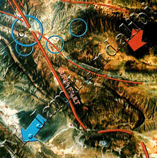
Gurm Fault, Southwest of Shiraz
A Rare Rupture with 5.2km Horizontal Surficial Displacement
(Middle Pleistocene)
Overall, his most important discovery is finding the new tectonic stress field in Shiraz area which includes two major compressive components (in contrast to the old hypotheses). The first component, having an azimuth of 31°, is an affectual factor for displacements in the eastern blocks that have been separated by capable causative dextral faults, and the second component which has an azimuth of 311°, changes the axis of folded structure and also controls the shortening (Structural Contour Map of Shiraz. Andalibi, Oveisi, 1999). These criteria are mainly used in analyzing and interpreting different subjects in all majors of applied geological sciences.
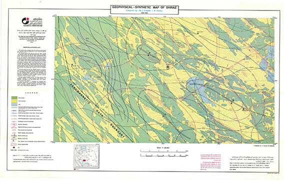
Geophysical Synthetic Map of Shiraz
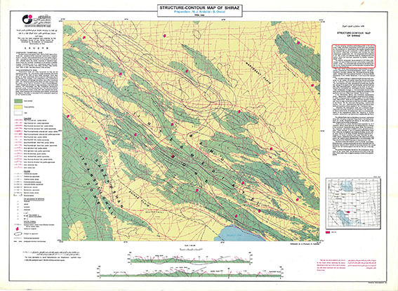
Structure Contour Map of Shiraz
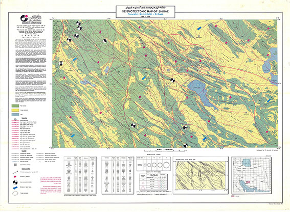
Seismotectonic Map of Shiraz
Broadly speaking, he studied most of the earthquake events and natural catastrophic phenomena inside and outside the country as in Siberia and the Arctic (1990), Tibetan Plateau (1991), Quaternary volcanic regions of Japan (1992) and so on, which helps him explain and analyze certain peculiarities of the evolution of our planet.
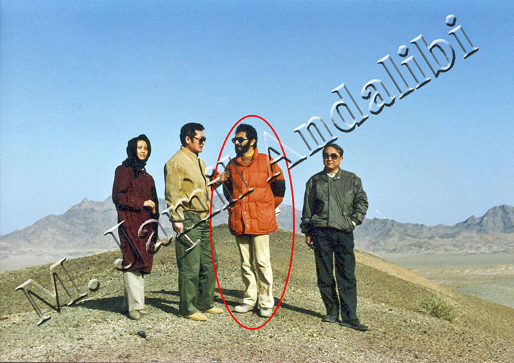
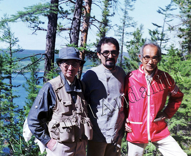
Dr. M. Jamil Andalibi in the Group of Foreign Experts
(Reconnaissance in Kerman and Yazd Provinces and Central Iran (Including Nehbandan, Tabas and Posht-e Badam Areas))
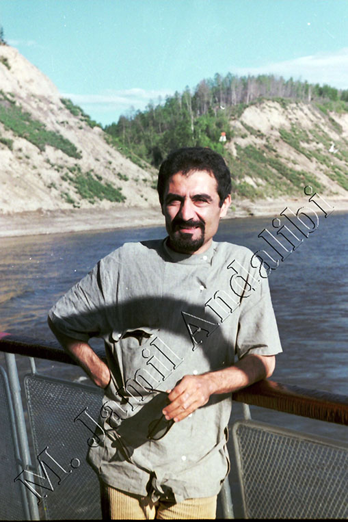
Dr. M. Jamil Andalibi, Siberia, 1990
(Terrace Structures in Left Bank of Lena River)
From Left to Right:
Prof. Hisao Kumai (Department of Geosciences, Osaka City University, Japan),
Dr. M. Jamil Andalibi (Geological Survey of Iran),
Prof. Nakagawa Hisao (Tohoku University, Japan).
(Left Bank of Lena River, on the top of Carbonate Marine Limestone (Age: Vendian-Cambrian), Siberia, July 1990)
Dr. M. Jamil Andalibi in the Field Observation Group, Siberia, 1990
(Stop 8: The Right Bank of Lena River)
Books
(M. Jamil Andalibi, Behnam Oveisi)
- Modern Seismotectonics
- Schizosphere in Subsurface Control
- Seismicity of Shiraz Area
- Seismites and Paleoseismograms
- Seismic Precursors
- Seismicity and Seismic Risk
- Prevention of Earthquake Damages
- Urban Geology and Microseismic Zoning
- Results of Field Observations of 2 Earthquakes in Shiraz Area
Selected Papers and Discoveries
1. Quaternary Sediments in Western Part of Caspian Sea in Iran (INQUA, Canada, 1987).
2. Some Explanation about Golijeh Paleo-Lake, a Glacial Tectonic Lake (28th International Geological Congress, Washington D.C., U.S.A., 1989):
3. Recent Changes in Caspian Sea Level (3rd International Quaternary Stratigraphy and Events in Eurasia and Pacific Region, USSR Academy of Sciences (Siberia), July 1990).
4. Neotectonics and Climatic Change from Last Glaciation (China Academy of Sciences, China, October 1990).
5. Characteristics, Source and Classification of Loesses of Caspian Basin in IRAN (29th International Geological Congress, Kyoto, Japan, 1992).
6. The New Estimates of Neo and Seismo Tectonics in Zagros Belt (30th International Geological Congress, Beijing, China, 1996):
https://books.google.com/books?id=CdFNAQAAIAAJ&focus=searchwithinvolume&q=andalibi
7. The New Method for Increasing Constructions Stability against Earthquake Waves (30th International Geological Congress, Beijing, China, 1996):
https://books.google.com/books?id=CdFNAQAAIAAJ&focus=searchwithinvolume&q=andalibi
8. New Tectonic Units in Shiraz Area (Sabz Pushan and Bamou) (31st International Geological Congress, Brazil, 2000).
9. Characteristics of Induced Earthquakes (32nd International Geological Congress, Italy, 2004).
10. Systematic Analysis of Bam Earthquake (26/12/2003) (Asian Disaster Reduction Center, http://www.adrc.asia, Japan, 2003):
Systematic Analysis of Bam Earthquake on Dec. 26th 2003
11. Gurm Fault: A Rare Case of Surface Rupture with 5.2km Horizontal Displacement in Southwest of Shiraz (Andalibi & Oveisi, 1999).
12. Extraordinary Case of Horizontal Surface Displacement (8 - 12.5km) in Sarvestan and Runiz Areas, East of Shiraz(Andalibi & Oveisi, 1999).
13. Seismological and Field Observations from the 1990 November 6 Furg (Hormozgan) Earthquake: A Rare Case of Surface Rupture in the Zagros Mountains of Iran:
http://onlinelibrary.wiley.com/doi/10.1111/j.1365-246X.2005.02731.x/abstract
14. New Seismo Tectono Stratigraphic Zones in Zagros Belt of Iran (34th International Geological Congress, Australia, 2012).
15. Neogene-Quaternary Sediments in Western Part of Caspian Sea in Iran (RCMNS, Turkey, 2013).
16. Introduction of Neo and Paleo Shirazian Orogenic Phase in Middle Pleistocene (≈700,000 years BP) in Shiraz Area (Andalibi & Oveisi, 1999).
Gurm Fault, Southwest of Shiraz
A Rare Rupture with 5.2km Horizontal Surficial Displacement
(Middle Pleistocene)
Longtime Field Observations
- Long-term field studies and operations in Siberia and the Arctic region in order to achieve new findings about shield areas and their borders with non-shield areas (from seismic and tectonic points of view) (The Academy of Sciences of the USSR, Yakutsk, 1990)
- Long-term Field Studies and Operations in Tibetan Plateau of China, Studying Glacial-Eolian Loess Deposits (Paleo-Seismic Recorder in Quaternary) (Chinese Academy of Sciences, Beijing, 1991)
- Field studies in Quaternary volcanic regions of Japan with the purpose of comparing the chronology and petrology of volcanoes with similar phenomena in Iran (Academy of Earth Sciences, Kyoto (Japan), 1992)
- Field studies and observations in all parts of the country in order to achieve new discoveries in Quaternary, determining geo and seismo dynamics of the regions, and after all, seismic resistance microzoning of rural and urban areas.
Honors
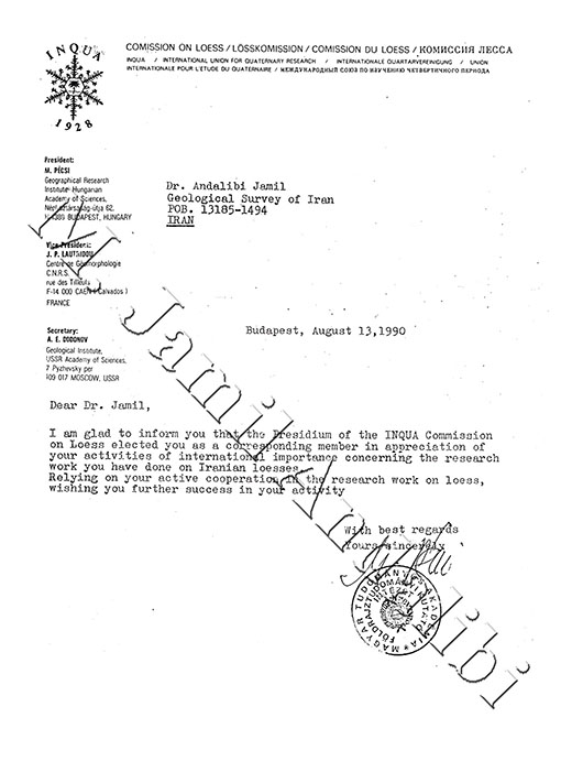
- Honorary doctorate from Budapest Academy of Sciences.
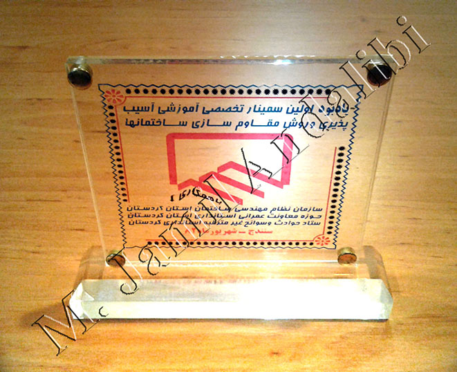
- Commemorative plaque of First National Seminar of Construction Retrofitting, Engineering Organization of Housing and Urban Development, 2003.
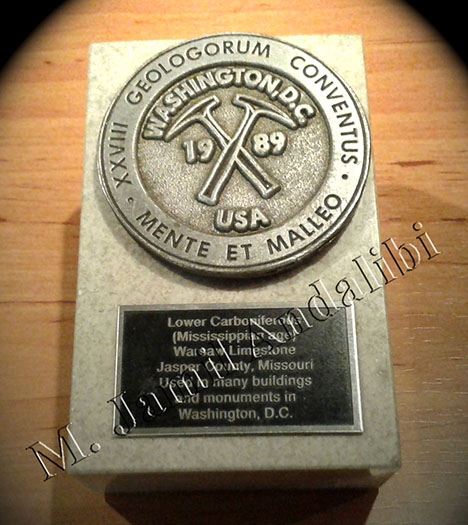
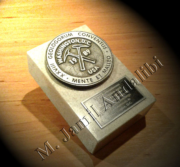
- Commemorative plaque of 28th International Geological Congress, Washington D.C, U.S.A., 1989.
|
|
|
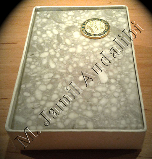
- Special prize and commemorative plaque of 29th International Geological Congress, Kyoto, Japan, 1992.
- Commemorative medal of International Symposium of Climatic Change from Last Glaciation, China Academy of Sciences, Beijing, China, 1990.
- Special prize and commemorative plaque of International Symposium of Quaternary Stratigraphy and Events in Eurasia and the Pacific Region, INQUA, Yakutsk, 1990.
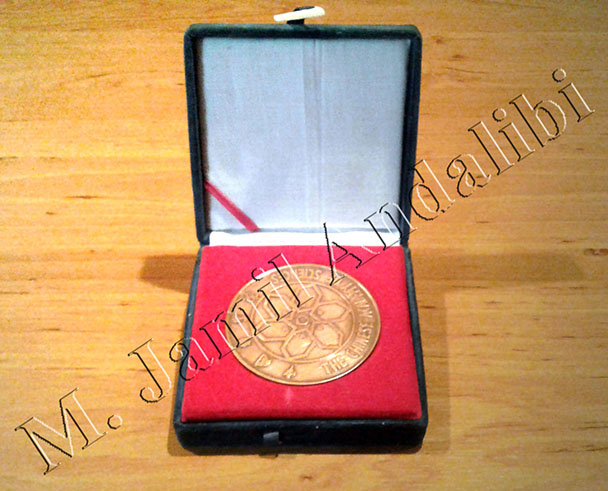
- Commemorative plaque of 30th International Geological Congress, Beijing, China, 1996.
|
|
|
- Special Prize of Iran International Music Festival, Tehran, 1976
External Links
- M. Jamil Andalibi | LinkedIn:
https://ir.linkedin.com/in/jamilandalibi
- Systematic Analysis of Bam Earthquake on Dec. 26th 2003, Asian Disaster Reduction Center (ADRC):
Systematic Analysis of Bam Earthquake on Dec. 26th 2003
- Seismological and Field Observations from the 1990 November 6 Furg (Hormozgan) Earthquake: A Rare Case of Surface Rupture in the Zagros Mountains of Iran, Wiley Online Library:
http://onlinelibrary.wiley.com/doi/10.1111/j.1365-246X.2005.02731.x/abstract
- 28th International Geological Congress, Washington D.C., U.S.A., 1989:
- 30th International Geological Congress, Beijing, China, 1996:
https://books.google.com/books?id=CdFNAQAAIAAJ&focus=searchwithinvolume&q=andalibi
- M. Jamil Andalibi, Wikipedia - The Free Encyclopedia (in Persian):
M. Jamil Andalibi, Wikipedia - The Free Encyclopedia (in Persian)
- Modern Seismotectonics, National Library and Archives of Iran (in Persian):
Modern Seismotectonics, National Library and Archives of Iran (in Persian)
- Investigations of Stratigraphy and Quaternary Geology Phenomena in Caspian Basin, Journal of Sciences, University of Tehran (in Persian):
Investigations of Stratigraphy and Quaternary Geology Phenomena in Caspian Basin
- Chronostratigraphy and Events in Pishva (Varamin, South of Tehran) Obtained from Archeological Excavations (in 58 pages):
http://www.gsi.ir/Images/engeo/pishva.pdf
- M. Jamil Andalibi, Research Institute of Sciences and Information Technology of Iran (in Persian):
Research Institute of Sciences and Information Technology of Iran
- National Geoscience Database of Iran:
- Systematic Analysis of Bam Earthquake on Dec. 26th 2003:
http://www.ngdir.ir/Downloads/Downloadme.asp?PartCode=1&FileCode=3003&DataCode=2910
- Investigations of Seasonal (Summer) Induced Earthquakes in Zagros Belt (Iran):
http://www.ngdir.ir/Papers/PapersDetail.asp?PID=7604
- Geohydrology and Structural Geology (Hydrology & Tectonics) of Abadeh, Eqlid and Surmaq Regions:
http://www.ngdir.ir/library/ListsDetail.asp?PID=524
- Quaternary Sediments in Western Part of Caspian Sea in Iran:
http://www.ngdir.ir/Library/ListsDetail.asp?PID=61466
- Geological Map Sheet of Sarvestan (1:100,000 Scale):
http://www.ngdir.ir/library/PListsDetail.asp?PID=64462
- Explanatory Notes on 3 Maps of Seismotectonics, Structure-Contours and Synthetic-Geophysics of Shiraz Area:
http://www.ngdir.ir/library/ListsDetail.asp?PID=22094
Note (1): Publications of Dr. M. Jamil Andalibi are available through internet with the following keywords:
“M. J. Andalibi”,
“M. J. Andalibi Geology”,
“M. J. Andalibi Earthquake”.
Note (2): A part of references to Dr. M. Jamil Andalibi are available through the following “Google Scholar” link:
https://scholar.google.com/scholar?q=%22andalibi%22+geology&btnG=&hl=en&as_sdt=0%2C5